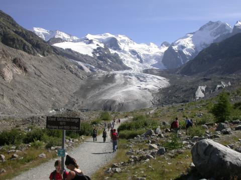
CHR intends to carry out a research project on the theme "The snow and glacier melt components of streamflow of the river Rhine river and its tributaries considering the influence of climate change."
This project was initiated against the background of the great socio-economic and ecological significance of the river and from the fact that the discharge regime of the Rhine is influenced enormously by meltwater and, on behalf of various circles (the general public, business, politics), there is a great need for findings on the changes that can be expected in the context of climate change. In spite of numerous investigative and research results that are available in this area, a qualified answer to this question has not yet been offered.
The draft of the project delineates the contents and projects a total of three main work areas (modules), which should allow the determination of the runoff amounts from snow and glacier meltwater for the given time period under observation. The award of contracts is envisioned for the compilation of these modules, and these are to be completed in a maximum time of three years. A fourth step, not at present available for tender, which will determine the snow or glacier related runoff amounts in the future, changed climactic conditions, is planned as a concluding phase and will be based on the results of modules 1 to 3.
Main work steps:
- Identification of the meltwater sourced runoff components (snow pack, glacial ice, and glacial snow) at partial, well-chosen districts of the whole Rhine basin, which have measuring points. Here, the project must take into account the glacier-influenced source areas in the Alpine region. The runoff amounts arrived upon must be calculated as part of a separation process, based on the measured gauge water/ hydrograph levels or calculated on this basis (daily values basis). Here the current runoff monitoring for the glacier run off in the source areas must be checked (homogeneity, data validity); or recommendations must be made for necessary new placements of the measuring stations, in order that the project is in the future less dependent upon the runoff predictions based on models.
These considerations should take into account the period form 1951 -2010 and possibly stretch to the beginning of the 20th century. - Identification and quantification of processes influenced by flood routing, and the relevant system components (dam control, lake regulation, detours, water table, etc.) as well as the creation and preparation of the respective characteristic values and hydraulic basic data (body of water cross-sectioning, etc.).
We seek here the creation of a flood routing model (if necessary, using the present models in the area under investigation). The model should be able to simulate the most important processes for a water body with regionally different flows and a number of large-area, effective water management measures based on daily values. The following must be integrated here:
- The current arrangements
- Those arrangements which were effective in the past (at least until the beginning of the 20th century).
Moreover, the model system must be set up in such a way that future scenarios, which could possibly contain relevant measures, can be integrated into it and their effect evaluated.
(Please note: The focus of the (routing) model development or data evaluation is on the area of the network of water bodies in the hydrological source area of the Swiss Rhine runoff area up to the gauge Basel. For the part of the river downstream to the gauge, there are either hydrodynamic models or flood routing schemes based on hydrological models or comprehensive databases. This data can be accessed by the project, if necessary.) - Quantification of the runoff amounts resulting from the meltwater for the gauge of the defined catchment area (including in a particularly accurate assessment for the Alpine Rhine and Aar River areas), for the inflow to Lake Constance as well as the Rhine River gauges Basel, Maxau, Worms, Mainz, Kaub, Andernach, Cologne and Lobith in the past and the present.
On the one hand, it must be possible to make an assessment (accurate on a daily value level) for the period 1951-2010 of the given meltwater amounts to any given time at the gauge points mentioned above. On the other hand, an overview for the meltwater amounts for the whole period on a monthly basis 1901-1010 is expected. In this part of the investigation we do not need a mapping of the routing processes.
Based on the results of modules 1-3, module 4, the quantification of the runoff amounts resulting from meltwater for the various gauges for the future can be produced at a later date.


